
Anderson Creek Watershed
Thousands of tired, nerve-shaken, over-civilized people are beginning to find out that going to the mountains is going home; that wildness is a necessity
― John Muir, Our National Parks
|
A watershed is the area of land that drains to a single body of water, in the case of Anderson Creek. The Anderson Creek watershed is located in Clearfield County and occupies portions of Bloom, Brady, Pike, Pine, and Union Townships. It is approximately 78 square miles and is the primary source of drinking water for DuBois and Curwensville. Anderson Creek flows a distance of about 20 miles and has a vertical drop of 960 feet. The watershed contains 120 miles of stream. The two major tributaries of Anderson Creek are Kratzer Run and Little Anderson Creek.
Problems Facing Anderson CreekAbandoned Mine Drainage (AMD)- AMD pollutes over 50 miles of streams in the watershed. ACWA sees this issue as the largest factor in the over all health of the stream. To find out more about AMD in Anderson Creek visit our AMD page.
Habitat- Streams in lower part of the watershed also face issues with a lack of habitat for fish and other stream life. Without adequate habitat streams are not as productive, and do not support as many fish. To find out what ACWA is doing to help the stream visit our Stream Habitat page. |
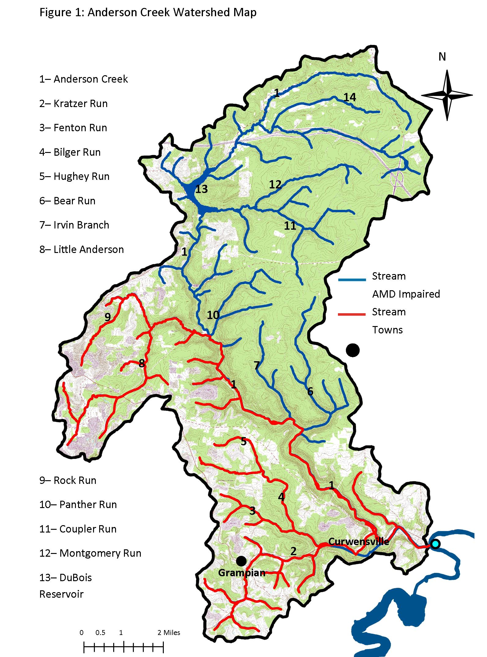
Click on map to enlarge.
|